
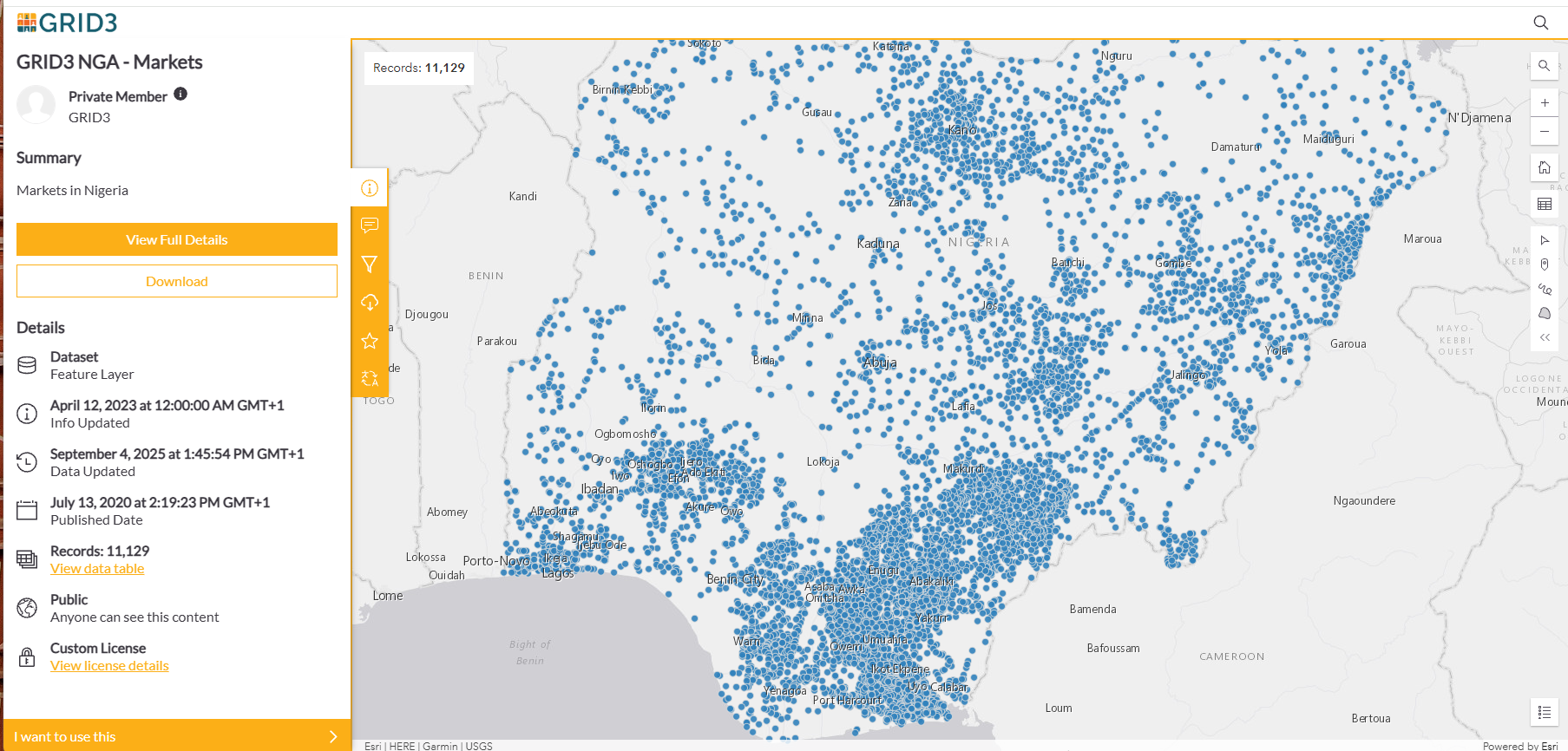
What can we do with data on the locations of markets across Nigeria to better connect the food system?
This is a question Palatehub has been exploring with The Olympus Consciousness Initiative (TOCI) over the last quarter.
For a producer, processor, buyer or logistics provider, knowing where markets are can open up further questions: Which markets might serve a production area? Where could a business investigate new sources of supply? How do markets connect to the communities around them?
These questions show why market-location data deserves attention. It provides a foundation for understanding the places where food, people and commercial activity meet.
Recognizing the foundation GRID3 has provided
Through its geospatial work in Nigeria, GRID3 has made valuable information about people, settlements and infrastructure available for planning and analysis. The GRID3 NGA Markets dataset is part of that contribution, providing mapped market locations that others can explore and build upon.
Making this information accessible is an important achievement. It gives businesses, researchers and development organisations a shared starting point for examining Nigeria’s market landscape.
The value extends beyond the individual locations. When market data is brought together with information about production, transport, population and trading activity, it can help people see relationships that would otherwise be difficult to examine.
At Palatehub, we see an opportunity to turn that foundation into practical tools for connecting the food system.
Helping producers and buyers explore their options
A producer considering where to sell may know a few familiar markets while having limited visibility of alternatives. A processor seeking raw materials may face a similar challenge from the other side.
A searchable market directory could help users identify locations worth investigating. Over time, adding verified information about the products traded, operating days and people involved could make that directory more useful.
This could support a clearer journey from finding a market to understanding whether it meets a particular need.
Understanding what moves through each market
Location data also provides a structure around which product information can be gathered.
What commodities are sold in a market? Where are they produced? Are supplies seasonal? Who are the producers, traders and other businesses involved?
Answering these questions could help build profiles of markets and their connections to production areas. For food businesses, such profiles could support sourcing and sales decisions. For researchers and associations, they could offer a better understanding of how trading networks function.
This additional knowledge would require investigation, participation and verification. The mapped locations provide the starting framework for that work.
Planning how food reaches the market
Combining market locations with suitable road, travel-time and logistics data could help businesses examine how products move between production areas and trading destinations.
Possible applications include identifying collection points, exploring delivery routes and comparing the accessibility of different markets. With further information about volumes and existing services, the same foundation could support decisions about storage, processing and distribution facilities.
The practical question is straightforward: Where would a service or facility help people move and retain more value?
Building better market intelligence
Market locations could also give commodity-price reporting a clearer geographic structure.
Prices become more useful when users know the market, date, product grade and unit to which they refer. Consistently collected observations could help businesses examine differences between locations and changes over time.
Such a system would need reliable reporting and careful comparison. Location data offers a way to organise those observations and relate them to the markets where trade takes place.
Supporting associations and public planning
Market associations, chambers of commerce and public institutions could use market-location data to organise engagement, identify areas for further research and examine the distribution of trading infrastructure.
Combined with population and accessibility information, it could help frame questions about which communities are well served and which may face difficulties reaching markets.
It could also provide a common reference for discussions between businesses, communities and institutions—helping them focus on specific places and practical needs.
From a useful dataset to useful connections
These possibilities are what make GRID3’s contribution so valuable. A shared data foundation allows different organizations to investigate problems, build tools and contribute further knowledge.
Palatehub and TOCI’s exploration begins with making market locations easier to find and understand. The next step is to investigate what is sold or produced in those markets and who the producers are.
For Palatehub, this work connects directly to our purpose: Connecting the Food System. Better information can help people identify opportunities, ask more informed questions and build relationships between production, value addition and markets.
The possibilities will take shape through the experience of the people who use, supply and work in these markets. Their knowledge is essential to turning locations into useful market information.
If you would like to know more or work on this project with us, follow Palatehub on LinkedIn, Facebook and X. We will share our progress and opportunities to contribute as the work develops.